


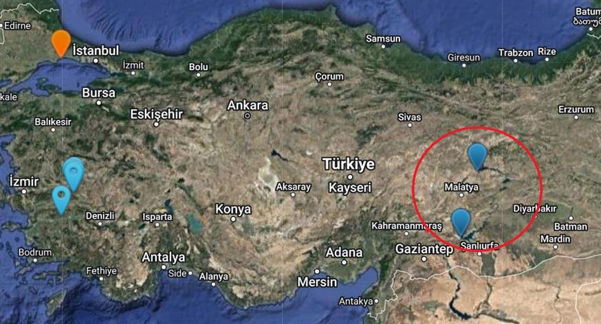
A study published in the journal Seismological Research Letters (https://pubs.geoscienceworld.org/srl) in 2017 identified 730 locations where human activity caused earthquakes in the last 150 years! Among the 730 locations, two are located in the area of Monday’s deadly earthquake as shown on the map below.
The researchers were surprised to find that human activity has caused earthquakes as large as 7.9 on the Richter scale and that the number of earthquakes is increasing exponentially in some areas of the world.
“Man-made” earthquakes can be caused by a wide range of causes. The main causes are:
1. Mining of ores
Mining is an age-old activity. Today, mining companies are digging deeper into the Earth’s crust than ever before. Rocks and other materials dislodged from the subsoil cause instability, which in turn causes earthquakes. In 2007, the Crandall Canyon coal mine in northwestern Emery County, Utah, USA, collapsed causing a 3.9 magnitude earthquake in the area. Six miners were killed inside the mine and three rescue workers died trying to free miners.
2. Dams
The construction of dams has created some of the largest and deadliest man-made earthquakes in history. The 2008 magnitude 7.9 earthquake in Sichuan Province, China was a catastrophic event that scientists believe was caused by damming that caused 320 million tons of water to pool over a known fault beneath the Zipingpu Dam. Around 80,000 people then lost their lives or were declared missing.
3. Extracting oil or natural gas
In the US, the practice of fracking to extract oil or natural gas causes many man-made earthquakes. Fracking involves injecting fluid at high pressures into underground rocks in the hope of opening existing cracks to extract oil or gas. In the US, many people who live near fracking sites have filed lawsuits for injuries they suffered from earthquakes, as well as damage to their homes.
4. The nuclear explosions
The guilty Atatürk Dam
And we come to the Turkey-Syria earthquake that monopolizes the interest of the news in the entire planet.
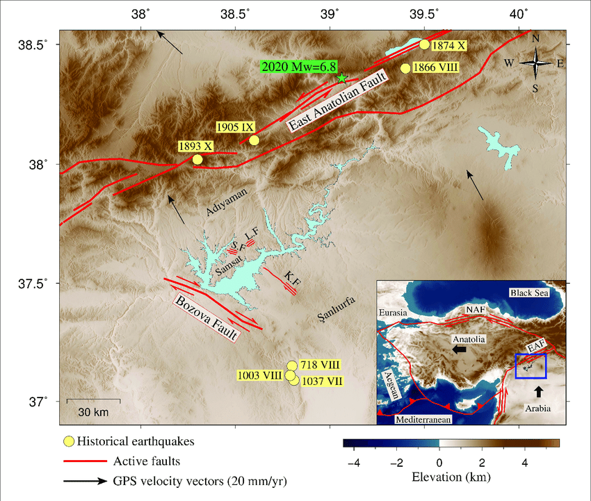
5 years ago a report was published on the scientific site temblor.net – the creation of USGS (United States Geological Survey) scientists Ross Stein and Volkan Sevilgen – where reference was made to the beastly Ataturk Dam located relatively close to the area hit by the earthquakes.
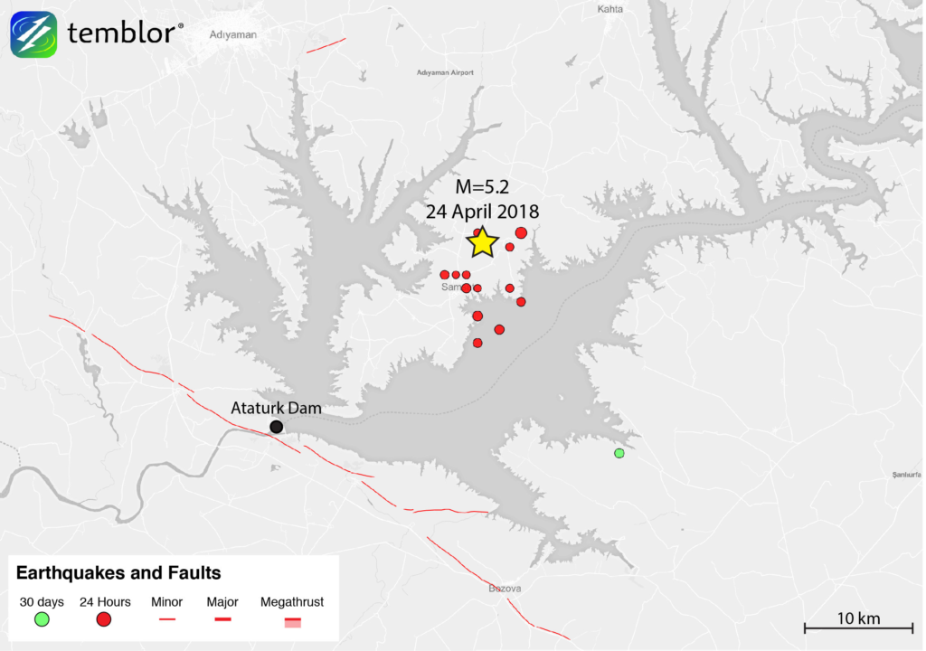
In 2018, southeast Turkey was hit by a strong earthquake that left behind dozens of injured people and buildings – ruins in the small town of Samsat.
The report noted, “While much of Turkey is prone to moderate earthquakes, this region has historically produced almost no catastrophic earthquakes.”
The 2018 earthquake came nearly a year after a magnitude 6.6 earthquake shook the region, destroying buildings and injuring five people. The epicenter of that quake was just six kilometers west of the 2018 quake.
And here we come to human activity: in that area is the Atatürk Dam, the third largest dam on Earth. While the 2018 earthquake did not cause any damage to the dam, the dam itself and the change in water levels in the reservoir are speculated to cause earthquakes.
But the same did not happen five years later. Monday’s earthquake has killed thousands, leveled cities and left the Atatürk Dam itself with cracks that provoke anxious thoughts.
Seismic activity in the wider area became particularly evident shortly after the dam went into operation. The Marmara Research Center first pointed out that in 1994, when the dam reached almost full water capacity, small earthquakes began to occur, but with surprising frequency, given the low seismicity of the area.
Then, in the summers of 2007 and 2008, the water level in the dam dropped dramatically due to minimal rainfall; then, on September 3, 2008, an earthquake struck. The scientists concluded that the rapid water loss changed the behavior of the region’s subsoil.
And they point out to temblor.net: “While we do not claim that the 2018 earthquake was caused because the area has strong seismicity associated with the Atatürk Dam, it should be considered as a possible cause. In addition, it should be noted that in the last year (2018), the water level in the Atatürk Dam has dropped significantly.”
And he concludes: “Although the region historically has not produced large earthquakes, this does not mean that a larger and more destructive earthquake could not occur. Therefore, the earthquake (of 2018) should cause constant vigilance in the region”; and Monday’s earthquake came and caught scientists and residents asleep. It should be noted that 153 earthquakes have been recorded in the area in the last year, with the strongest one of 7.8 last Monday.
And the Dam has been injured
And after the devastating earthquake, reports arrive from the Dam officials that “there are many cracks”. The surrounding areas have already been evacuated. The static adequacy of the dam is now in jeopardy. Of course, as engineers pointed out, the fact that cracks were detected does not mean that there is a risk since the reinforcement is what holds the structure, but…
Experts warned that the dam could collapse at any time and its destruction could affect an area of 30 square kilometers around the dam.